
Subdivision, Land Development & Submission Requirements
Important update to the Subdivision and Land Development Plan Submission Process
Applications must be submitted 28 days prior to the Planning Commission Work Session Meeting. This new deadline offers a review period that allows officials to make a decision on an application, helping to create a more streamlined and organized administrative process for every land development plan and subdivision application that comes into the Township.
Application Process
1. Pre-Application Conference
2. Application Submitted (28 days prior to Planning Comission Work Session Meeting)
3. Review – Staff, Engineering, County
4. Planning Commission Review (90-day MPC "Timeclock" Begins)
5. Planning Commission Recommendation
6. Elected Officials’ Review
7. Elected Officials’ Decision
8. Recording of Plan
Timeline
About
A Subdivision Plan is required to be submitted in accordance with the provisions of Chapter 22 when the following action is proposed:
The division or redivision of a lot, tract or parcel of land by any means into two or more lots, tracts, parcels or other divisions of land including changes in existing lot lines for the purpose, whether immediate or future, of any of the following: lease, partition by the court for distribution to heirs or devisees, transfer of ownership or building or lot development.
A Land Development Plan, prepared in accordance with the provisions of Chapter 22, must be submitted when any of the following are proposed:
- A proposed use or structure that is located within 100’ of a floodplain boundary
- A proposed use or structure that is located on steep slopes as stipulated by Chapter 27, Section 802
- A proposed use that is required to provide a parking lot as stipulated by Chapter 27, Section 809
- The location of two or more primary uses or structures on a single lot. This includes, but is not limited to the following:
- Apartment complexes
- Mobile home parks
- Shopping centers
- Industrial parks
- Any expansion of a commercial or industrial use
- Any non-residential structure on a lot or lots regardless of the number of occupants
- The division or allocation of space or land, whether initially or cumulatively, between or among two or more existing or prospective occupants by means of, or for the purpose of, streets, common areas, leaseholds, condominiums, building groups or other features
- A subdivision of land
Click here for the Guide to Subdivision and Land Development.
Plan Submission Requirements
After plan requests are submitted and approved by the Planning Commission and the Board of Supervisors, applicants are required to submit their submissions in digital form to the Planning Office. This Resolution No. 2003-32 was approved December 8, 2003.
Section 1 Specific Requirements for Digital Filing
- CD (s)
- File Format - ArcView Shapefiles, ArcInfo Coverage, AutoCad DXF
- Coordinate System - Pennsylvania State Plane North
- Units - U. S. Survey Feet
- Datum- NAD83
Click here for the Land Development Plan Application.
Ferguson Township can prepare the plan in digital format for applicants who are unable to. There is a charge for this service. Please consult the Township's Fee Schedule.
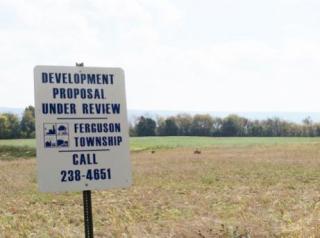
Please contact the Department of Planning & Zoning by email or call the Township at (814) 238-4651 for more information.